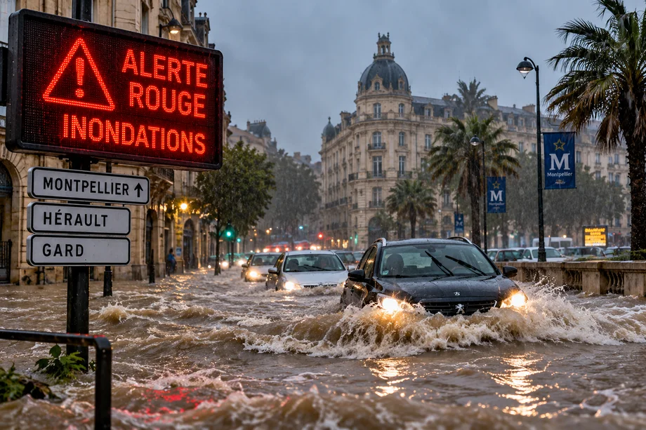
Southern France is facing a major flooding emergency as exceptionally intense rainfall hits the Mediterranean region, triggering the highest level of weather warning in Hérault and Gard.
Météo France placed both departments under red alert for rain and flooding on Wednesday, September 30, as a powerful Mediterranean weather episode brought torrential downpours across southeastern France.
The situation is particularly serious around Montpellier and other parts of Hérault, where extremely heavy rainfall has caused flooding and dangerous conditions on roads.
Météo France warned that the event could have serious consequences for people and property, with flash floods capable of developing rapidly.
Montpellier faces intense rainfall
Montpellier is among the major population centers affected by the severe weather.
Météo France forecast around 70 millimeters of rain for Montpellier during Wednesday afternoon, followed by another 25 millimeters during the evening and approximately 60 millimeters overnight.
Thunderstorms and strong winds were also expected, with gusts potentially reaching around 65 kilometers per hour.
Across Hérault and the Cévennes area, rainfall intensity reached approximately 60 to 100 millimeters per hour in some locations on Wednesday morning.
That means as much as 100 liters of water could fall on every square meter of ground in just one hour.
Images from Montpellier and surrounding areas showed flooded streets as the intense rain disrupted daily life.
Up to 400 millimeters of rain possible
The rainfall totals expected from this weather system are exceptional.
Météo France said areas of the Cévennes could receive between 250 and 350 millimeters during the episode, with isolated totals potentially reaching 400 millimeters.
That is equivalent to approximately 400 liters of water falling on every square meter.
Across a broader area covering parts of Gard, Hérault and Lozère, rainfall totals of 100 to 200 millimeters are expected to be widespread.
Some locations could receive between 200 and 250 millimeters.
Such enormous amounts of water falling within a short period dramatically increase the danger of flash flooding, overflowing rivers, landslides and mudflows.
Red alert issued for Hérault and Gard
The red warning represents the highest level in France's weather alert system.
Météo France advises people in areas under red rain and flood warnings to remain indoors whenever possible and closely follow instructions from local authorities.
Residents are specifically advised not to use their cars, stay away from rivers, bridges and low lying areas, avoid basements and move to higher floors if flooding threatens their property.
Schools were closed in parts of Gard as authorities responded to the dangerous conditions.
Local authorities also activated emergency alert systems to warn residents.
The risks are particularly significant because Mediterranean storms can cause rivers and streams to rise extremely quickly.
Why is southern France experiencing such extreme rain?
The event is known as a Mediterranean episode.
These weather systems typically occur during autumn when warm, moisture rich air from the Mediterranean Sea moves toward southern France.
When that air encounters colder air and mountainous terrain, particularly around the Cévennes, powerful thunderstorms can develop.
The storms can remain over the same area for extended periods, repeatedly releasing enormous quantities of rain.
Météo France explains that Mediterranean episodes can deliver the equivalent of several months of normal rainfall within only a few hours or days.
This week's event is the first major Mediterranean episode of the 2026 autumn season.
Flash floods are the biggest danger
One of the most dangerous characteristics of these storms is how quickly flooding can develop.
Unlike slower river floods that may take days to reach their peak, waterways in the mountainous areas of southern France can rise dramatically within hours.
Climate scientist Philippe Drobinski told Le Monde that the hydrological response in these regions can be almost immediate because rivers are steep and confined by the terrain.
That leaves residents and travelers with very little time to react.
Roads that appear safe can become impassable rapidly, while water flowing across streets can become powerful enough to move vehicles.
Travel disruption possible across southern France
The severe weather could create significant disruption for people traveling through southern France.
Montpellier, Nîmes and Alès are among the urban areas identified by Météo France as facing particularly intense rainfall and surface flooding.
Travelers in affected areas should check local road conditions and transport updates before starting journeys.
Driving through flooded roads is particularly dangerous because the depth and strength of moving water can be difficult to judge.
Authorities are advising residents in red alert areas not to travel by car unless absolutely necessary.
Anyone visiting Montpellier, the wider Languedoc region or nearby Mediterranean destinations should continue monitoring official weather warnings.
Storm threat continues into Thursday
The danger is not expected to disappear immediately.
Météo France said intense thunderstorms and rain will continue around the Gulf of Lion into Thursday, October 1.
The system is expected to gradually move east, with potentially significant rainfall continuing across southern Gard, Bouches du Rhône and western Var.
The latest national forecast also keeps Hérault and Gard under red rain and flood warnings, while other southeastern departments face lower level alerts.
Conditions are expected to improve later in the week, although some showers may continue across southern regions.
Until then, authorities are urging people across the affected areas to treat the warnings seriously and avoid unnecessary travel as southern France experiences one of the most intense rainfall events of the season.